Boston’s climate initiative and its obstacles to implementation
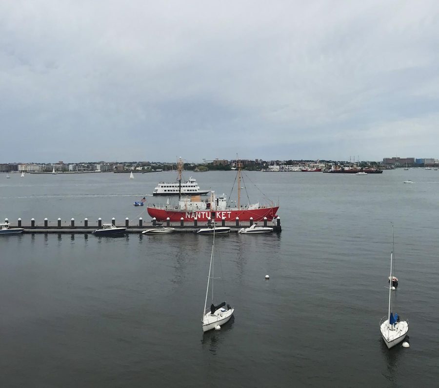
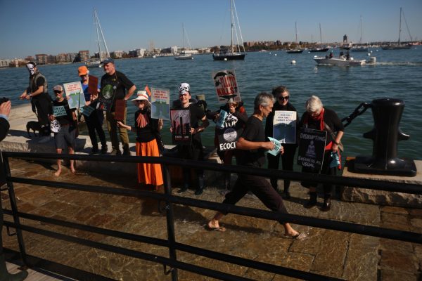
Photo: Lex Weaver
A view of the Boston Harbor from the Seaport district in 2019.
In the coming years, Boston will face extreme flooding from rising sea levels and larger rainstorms. Much of Boston is built on low-lying, marshy land. Some neighborhoods could see a tenfold increase in flood risk by the 2030s; thousands of buildings will face regular flooding by the 2070s, and much of the city may have to be abandoned altogether.
The Climate Ready Boston Initiative, run by the City of Boston, was designed to research and plan for the impending effects of climate change. Looking at Climate Ready’s self-reported progress from 2019, it seems light on results. It sorts different action guidelines into four categories — “not started,” “in development,” “in progress” and “complete.” Most of the goals aren’t complete, and if you read closely, the goals aren’t to build per se but to “develop action plans” and make reports on what should be done.
Climate research is a robust field in Boston, but progress often languishes when it comes to project implementation. Funding is scarce compared to the millions and millions of dollars needed to fulfill the city’s mandate to protect its residents. On top of that, these development projects are infrastructure and require coordination across multiple agencies and between city and state government.
Considering the obstacles, it makes sense for climate planning to be slow, but this pace is not enough to prepare Boston for how swift the effects of climate change will be.
Climate Ready has several programs devoted to different neighborhoods in Boston, like South Boston and East Boston, which are more vulnerable to flooding than other neighborhoods — and as such, stand as the first line of defense from the shoreline.
Phase 1 of the Charlestown and East Boston Climate Ready programs culminated in a report by the firms Stoss Landscape Urbanism, Kleinfelder and ONE Architecture & Urbanism. Among others, the report specified the Greenway and Schrafft’s Center Waterfront as prime places to build up against the forces of coastal flooding. Raising Main Street in Charlestown by two feet was another recommendation.
The report also came complete with timelines for action — optimistically beginning from 2017, when it was published. Five years later, what’s the status? The city’s website says, “We are currently leading a study to understand risk and identify near- and long-term solutions for areas of the neighborhood that weren’t covered in 2017.”
“Essentially, the way that we chart our timelines is based out of the flood mapping data that we get, and we’re using the same model that we’ve used for the previous reports,” said Zoe Davis, a project manager on the Climate Ready Boston team. “In terms of how the timelines align because we’re using the same model, the data might be slightly updated, but the timelines will sort of align in that way. They are also based on the timing of the flood pathway. And we have identified two primary planning horizons, so everything that we’re planning for currently sort of falls within just the 2030, 2070 timeline.”
For South Boston, a Climate Ready project was proposed to redevelop Joe Moakley Park. Alternately referred to as the Moakley Preliminary Resilience Plan or the Moakley Vision Plan, the designs intend to protect the park from coastal flooding and a projected sea-level rise from 21 to 40 inches. Stoss Landscape Urbanism, the architecture firm leading the project, went with what’s known as a nature-based design approach — with 500 new trees, coastal marshes and shrublands to serve as a buffer and beautify the area as a plus. It was also suggested that Day Boulevard, a road between the park and the shoreline, should be converted into a car-free promenade.
Amy Whitesides, studio director at Stoss, says climate development projects can be especially complicated to implement. To take Moakley Park as an example, the design must simultaneously keep water out from the coast and redirect rainwater from land to the harbor.
“Even if, ultimately, the project is a landscape that’s raised three or four feet up from the existing grade — at one level, it’s kind of straightforward and, you know, it’s kind of like any other park. It’s just higher than any other park,” Whitesides said. “But all of what happens underground and the regulatory processes are much more complicated, and the community engagement process can be more complicated because of that sort of demand. There’s interest and demand for something now. And those can be in conflict with what is needed to protect from a future condition.”
While progress on the Moakley plan seems to be ongoing, there haven’t been regular updates since 2020. Much of the process so far has been dedicated to community feedback.
“More and more, we’re moving; we’re trying to move into this space of continuous conversation around the resilience solutions being developed. We have a formula of connecting with communities over specific points in time in the study,” Davis said. “But we’re also trying to identify ways for ongoing conversation. I think by nature, ongoing conversations are not necessarily streamlined, whether it’s with communities or other stakeholders.”
The Dorchester Reporter covered a 2019 community meeting with Boston officials and the Stoss design team; multiple officials are said to have assured residents of a lack of any concrete project timeline. The Moakley plan is in the schematic planning stage — the first step in the architectural design process. According to The Reporter, Allison Perlman of the city’s parks department said at a December 2020 meeting that if the Moakley project did go through, it would be a phased construction over a period of 10 to 15 years and could cost over $240 million.
Several blocks over from Moakley Park, another development project seems to be sailing through. The Dorchester Bay City plan, led by real estate development company Accordia Partners LLC, filed its project notification form with the Boston Planning and Development Agency in Sept. 2020. The development would encompass 36 acres of office, retail and housing space and could take 10 to 15 years to complete. Accordia plans to spend $57 million on building flood prevention measures after climate concerns were raised.
“I think looking at the Dorchester plan is a really good example of where we’re recognizing, from Oakley Park and the Dorchester Bay City area, we know that these are going to be significant developments. Right now, we don’t have specific designs for this, but we have to account for what the tie-ins may be,” Davis said. “And then we have ongoing conversations with Moakley, with the Parks Department, understanding what the actual design is, and then actually coordinating additional planning as they’re preparing for construction or maybe additional studies.”
Some have compared Dorchester Bay City to the Seaport, a district in South Boston that was developed with billions of dollars in funding over the past two decades. While modern-day development plans pay at least some lip service to climate resiliency efforts, the Seaport project began in the 1980s and predated that expectation. The astronomical amounts of money devoted to the Seaport’s construction could wash away under the looming proximity of the water. The district has faced scrutiny for other reasons. Reporting by the Boston Globe’s Spotlight team in 2017 found that it was remarkably racially siloed, being 89 percent white.
Rebecca Herst is the director of the Sustainable Solutions Lab (SSL) at UMass Boston, whose researchers study climate change with a focus on disenfranchised communities and local issues.
“When you have a private developer that wants to move forward on a project and is financing it themselves, it’s much easier to move forward than it is for the city that is like, ‘Okay, we have this plan, but we don’t yet know how we’re going to pay for it,'” Herst said, adding, “That’s part of what’s going on, that part of it is about financing, part of is about access to capital, and part of it is about regulations and what’s allowed where and why.”
A report released by SSL in Jan. 2022 studied East Boston and potential projects that could be developed in the neighborhood to protect it from flooding and sea-level rise. According to the report, some of the projects the City of Boston would like to advance in East Boston aren’t currently possible due to the regulatory restrictions of designated port areas (DPAs). The Boston Planning & Development Agency requested that the state review the DPA boundaries in East Boston, but residents fear high-end developments will take advantage of deregulation and gentrify the neighborhood.
A variety of proposed climate solutions and backup systems is, in theory, a net positive — but with limited funding, you have to pick favorites. One point of contention is whether to focus on nature-based solutions, like coastal habitat restoration, versus “gray” solutions, like filling shorelines with manmade materials. Others say neighborhood-level climate initiatives aren’t thinking big enough and focus on pushing region-wide mitigation.
The Boston Harbor Storm Surge Working Group, according to their website, is an organization pushing for a massive “layered defense” system: “where a system of land based sea walls would protect local communities from sea level rise, and an integrated regional sea gate system would protect all fifteen cities and towns that flood through Boston Harbor from the devastation of storm surge.” Previous work by The Scope reported on the group and their advocacy efforts. An SSL report in 2018 argued that such a harbor barrier could cost upwards of $11 billion and would have major technical challenges and marginal benefits. The city subsequently shelved the idea and continued to focus on Climate Ready’s neighborhood-level approach.
In April of this year, Boston Mayor Michelle Wu appointed James Arthur Jemison II as chief of planning and director of the Boston Planning & Development Agency. Wu has said she intends to abolish the BPDA as soon as possible and replace it with a municipal planning department that would overhaul zoning regulations and prioritize affordability and climate resilience.
“I know that at different levels this is being looked at, but there is a bit of a review that needs to happen, and probably some regulations — not that they need to become less strict, but that they need to be revised to allow for things that weren’t in the past with new understanding, and with potentially new guidelines and regulations that help everyone do these things in the ways that are going to be environmentally positive as possible,” Whitesides said.
Community building is crucial, too, according to Herst. “Climate change does not respect municipal boundaries. Floods aren’t, like, ‘Whoops, this street turns into Medford, guess I’ll stop here!'” Herst said and added, “To build a truly resilient city, we need to not just be focusing on physical infrastructure, but also be focusing on relationships and supporting people in collaborating with each other.”
Boston isn’t lacking great minds or brilliant design plans, but the implementation of climate resilience plans must be done sooner rather than later. If not, the city may have to organize another initiative — to plan for the climate displacement of its residents.